Innovation drives efficiency
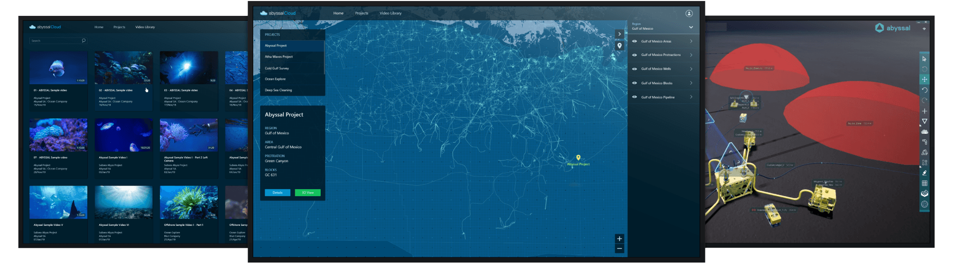
Abyssal Cloud is a web application and managed cloud platform with integrated data services. It allows you to manage, visualize, and interact with your subsea digital twin throughout the entire life cycle.

Data Correlation
Abyssal Cloud provides powerful collaboration and control tools so that you can bring people, processes, and tools together to treat and build value from live or historical data.

Transparency and privacy

Speed, reliability, and productivity
![]()
Better. Faster. Safer.
- Project transparency
- Reduced installation days
- De-risked offshore installation
- Easy access to data
- Live operational visualization
- Field design optimization
- Less personnel offshore
- Integrated digital life-of-field
- Key facilitator for remote operations
- Significant reduction of operational risks
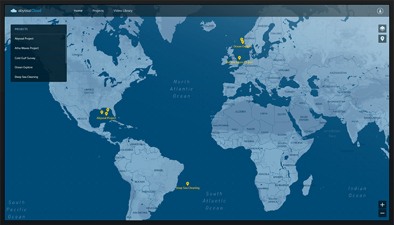
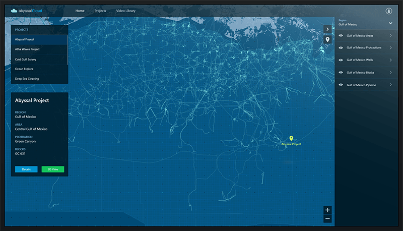
Geographical Project Management
2D GIS application to visualize all your world-wide projects, with contextualized data.
Secure Login Through OAuth
GIS Data
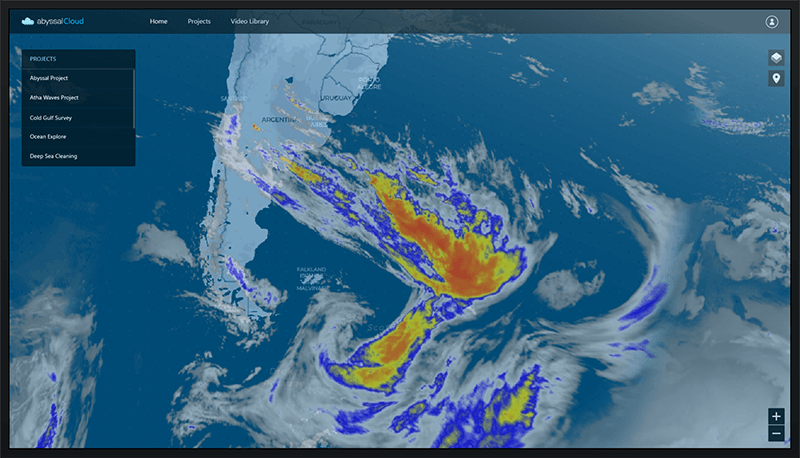
Live Geographical Weather Information

Project Portfolio Management
Worldwide project data in a single visualization platform that can be linked to other platforms for KPI information.
Survey Grade GIS System
Abyssal Cloud is powered by a survey-grade GIS system for all geographical data calculations.
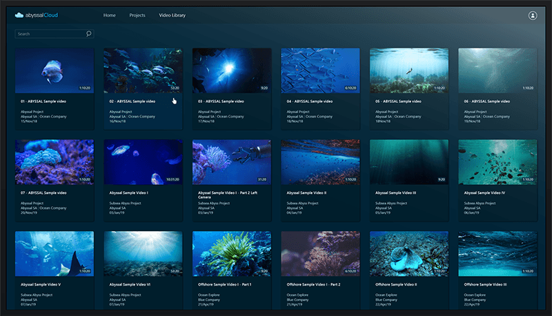
Video Library
Large database to store all your offshore videos with data correlation that allows you to manage, query, and easily access your videos in a digital environment.
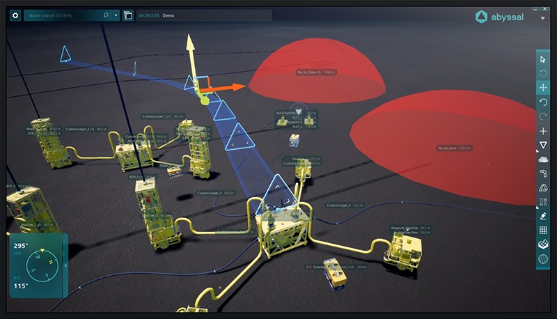
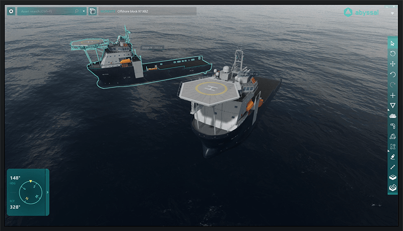
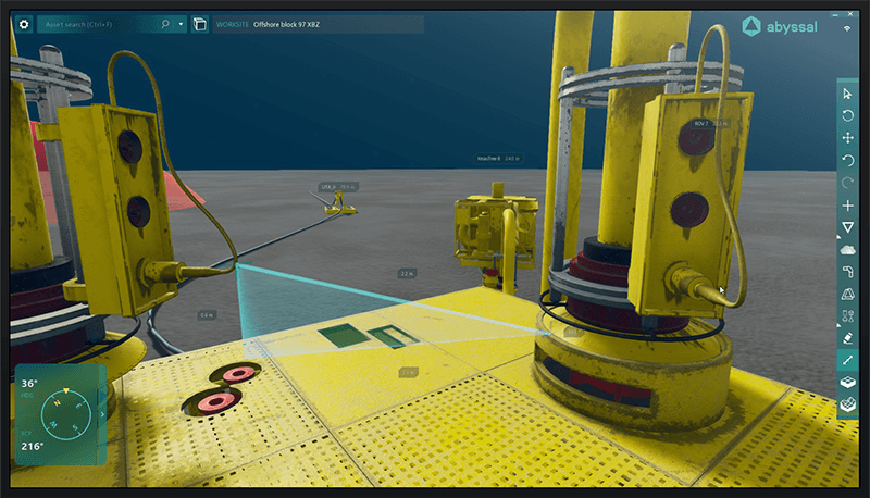
3D Digital Field
Navigate within the 3D digital replica of your field, creating, modifying, and using the models of the available assets in our software.
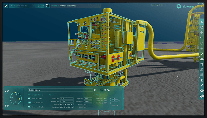
Asset Visualization
SIMOPS Planning
Field Measurements
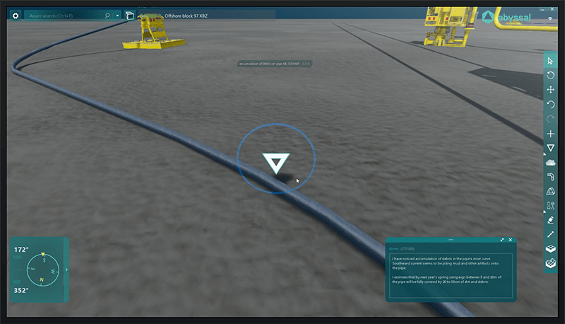
Geotagged Annotations
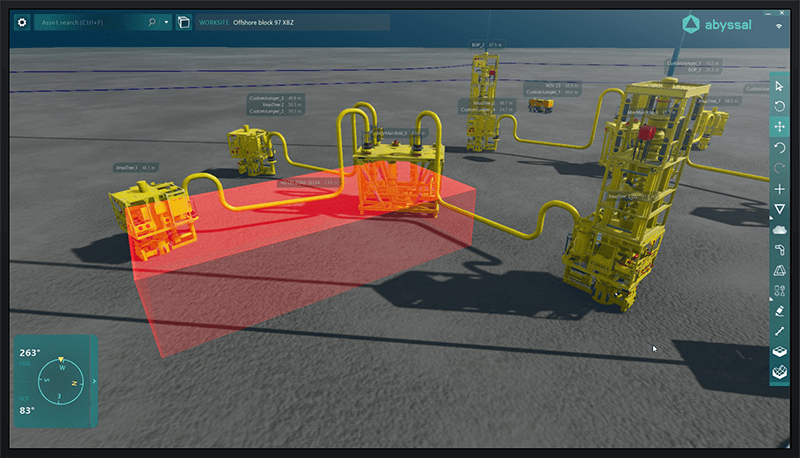
Risk and Anomaly Visualization
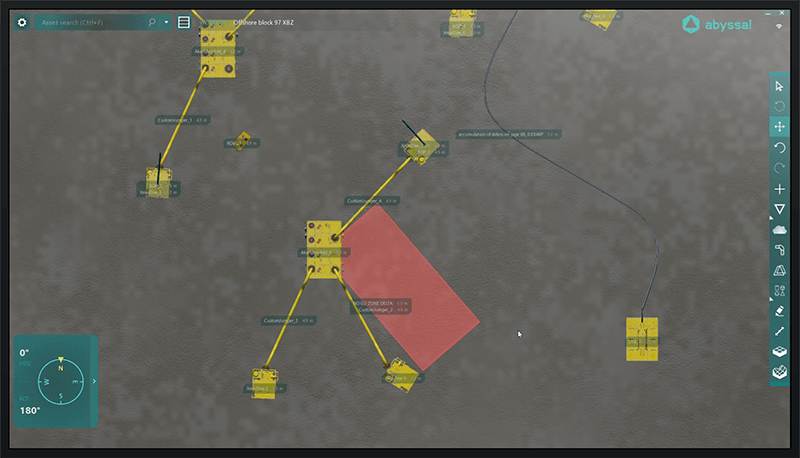
Project Status Updates
Partners and Clients


Compatible with your favorite tools, devices and vehicles


Find out more about
our products for
Design and Engineering
Learn how our digital tools can drastically enhance design and engineering processes by applying 3D visualization and simulation with accurate GIS.
Our Digital Twin data integration capabilities allow you to manage data from different years, formats, and suppliers to achieve a comprehensive collaboration and seamless handovers.
![]()
Installation and Operations
Learn how our real-time 3D visualization of subsea assets coupled with augmented reality, embedded in a fully-accurate GIS positioning system can drastically increase safety and efficiency in offshore operations.
Within our full lifecycle approach, users can take advantage of the data generated in design and engineering phases to enhance execution and manage operational data in a single platform.
![]()
Autonomy
By leveraging our GIS, 3D, and simulation capabilities with the integrated operational and engineering data, our engineering teams are continuously developing robust AI solutions for the remote control of subsea vehicles, autonomous operations and asset integrity.
![]()
ABYSSAL’S LATEST NEWS
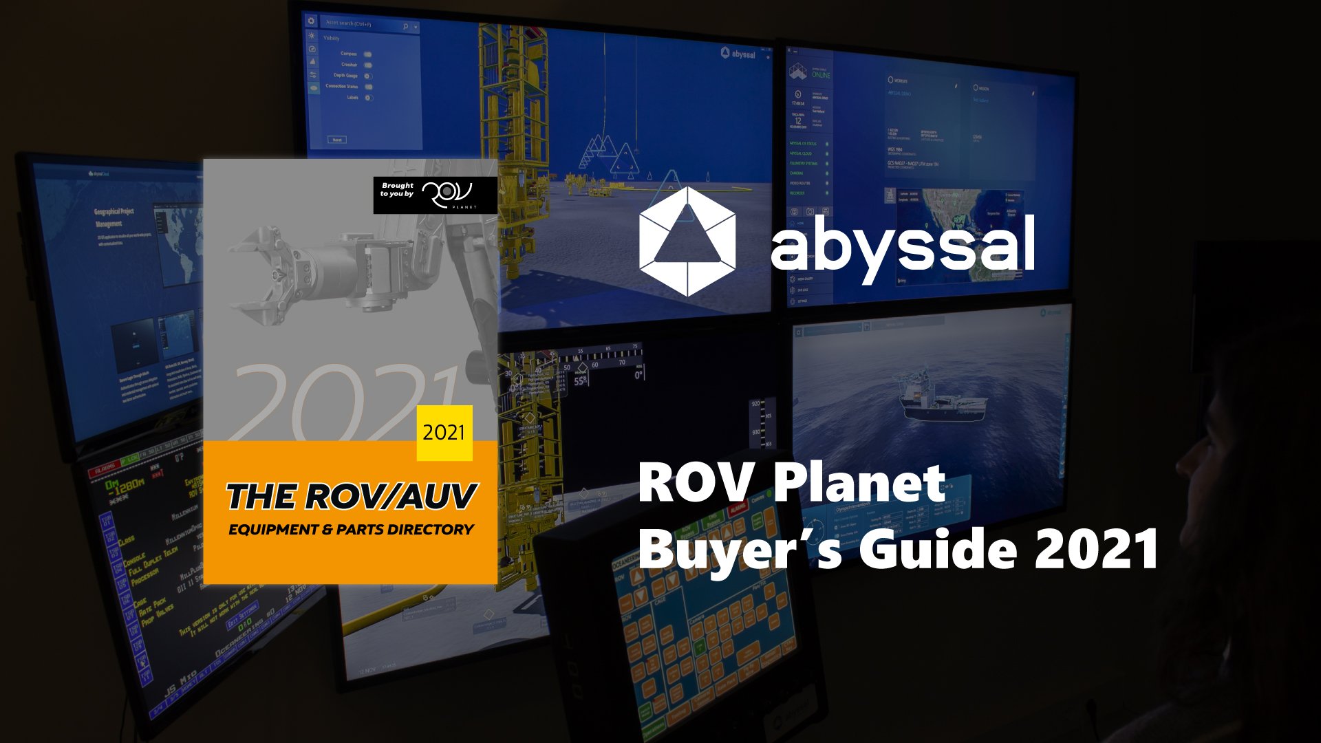
Abyssal featured in ROV Planet Buyers Guide 2021
Learn more about two of our star products – Abyssal Offshore and Abyssal Cloud – and how they can help with your Digital Video Recording and Offshore Monitoring Operations needs.
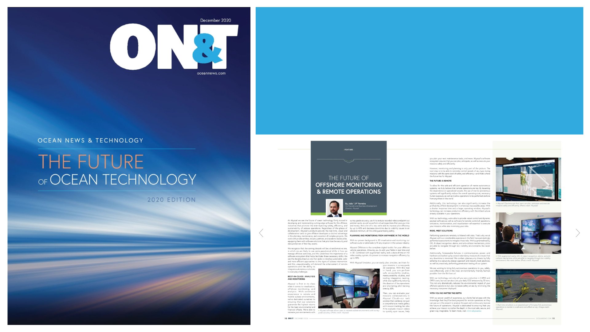
Abyssal featured on ON&T’s 2020 Special Edition
Discover how our technology and solutions are bringing value today and how we are working side by side with our clients to accelerate the future no matter the depth.
SUBSEA.AI Launch
Subsea.ai is a platform that you can use to prepare datasets, create, improve, and test AI models that will make your subsea operations Faster, Safer, and Greener.